Exeter’s position on the eastern edge of Dartmoor creates a geological puzzle that surface inspections alone cannot solve. Permian breccias and sandstones sit alongside faulted Carboniferous shales, while the River Exe carves through a floodplain of alluvial silts and gravels—a mix that produces dramatic resistivity contrasts across just a few hundred metres. When boreholes or test pits offer only point data, electrical resistivity tomography fills the gap, mapping lateral and vertical variations continuously. Our laboratory team runs vertical electrical soundings (VES) and 2D resistivity profiles across Exeter’s distinctive geology to track the sandstone-shale interface, locate buried channels filled with soft alluvium, and identify water-bearing fractures before excavation begins. For projects near the Exe estuary, where saline intrusion affects resistivity readings, we combine this method with CPT testing to calibrate geotechnical boundaries precisely. The result is a subsurface model that guides foundation depth decisions and dewatering design from St Thomas to Monkerton.
Permian breccias, Carboniferous shales, and Exe alluvium each carry a distinct electrical signature—learning to read it is what separates a useful survey from a misleading one.
Scope of work in Exeter
Critical ground factors in Exeter
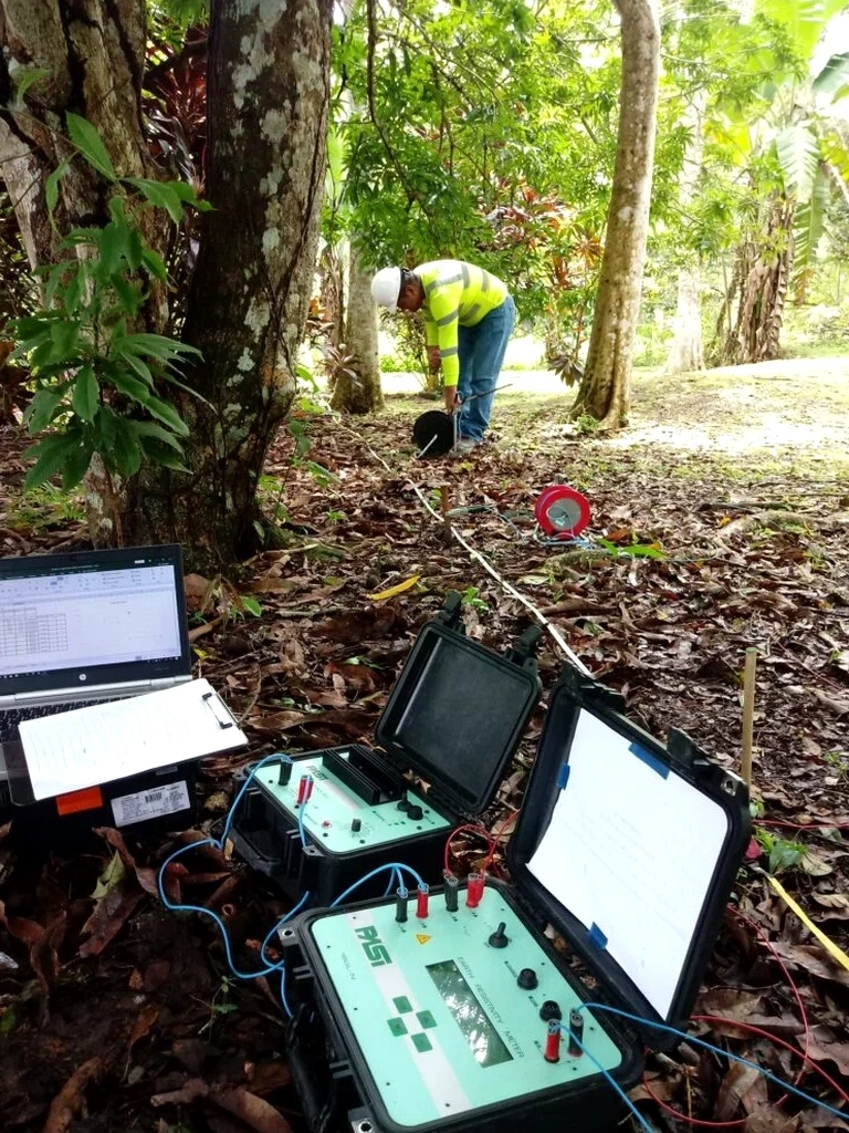
The Syscal Pro and ABEM Terrameter systems we deploy across Devon use stainless-steel electrodes and smart stacking algorithms that automatically reject noise from overhead power lines, buried services, and the electrified railway corridor that runs through Exeter. Without this filtering, resistivity data degrades rapidly—a serious problem on urban sites where stray currents from earthed utilities create false anomalies. Our field protocol mandates a noise test before every spread, adjusting the measurement cycle until the standard deviation drops below 2%. On wet winter days, when Exeter’s clay-rich soils become saturated, we shorten electrode contact resistance checks because surface conduction can mask deeper targets. The real risk lies in skipping this calibration: a misinterpreted low-resistivity zone might be called a clay pocket when it is actually a saline groundwater plume, triggering unnecessary over-excavation. We cross-reference every resistivity profile with at least one test pit log to anchor the geophysical interpretation in physical observation. That discipline has saved more than one Exeter contractor from chasing a phantom void that was, in fact, a buried cast-iron drain.
Our services
Every Exeter site has a geological question that needs answering. Our resistivity and VES services are structured to match the problem with the right technique.
Vertical Electrical Sounding (VES) for Depth Profiling
A single-point Schlumberger array that expands electrode spacing stepwise to map resistivity changes with depth. Ideal for locating the weathered rock boundary under Exeter’s Permian formations and estimating water table depth beneath sloping sites in Pinhoe and Pennsylvania.
2D Electrical Resistivity Tomography (ERT)
Multi-electrode profiles producing continuous cross-sections along linear routes. Used extensively for pipeline corridors, road widening schemes, and mapping the lateral extent of alluvial channels across the Exe floodplain.
Combined Geophysical & Geotechnical Interpretation
Resistivity data integrated with SPT borehole logs, laboratory classification tests, and groundwater monitoring to produce a unified ground model. This is the approach required by Exeter City Council for complex brownfield redevelopments with variable fill thickness.
Common questions
How much does an electrical resistivity survey cost in Exeter?
For a typical residential or small commercial site in the Exeter area, budget between £460 and £790 for a VES sounding or a short 2D profile with basic interpretation. Larger surveys covering longer traverses or requiring detailed 3D inversion fall at the upper end or beyond, depending on line length, electrode count, and reporting requirements.
What depth can resistivity imaging reach in Exeter's geology?
Penetration depends on array geometry and ground conditions. On the dry Heavitree Breccia we routinely achieve 25–30 m depth with a 200 m Wenner spread, while saturated alluvium near the Exe limits useful depth to around 15–20 m due to current shunting in conductive near-surface layers. VES soundings with large AB/2 separations can probe beyond 100 m when targeting deep bedrock structures.
Can resistivity surveys tell the difference between clay and water-saturated sand?
Both materials can show similarly low resistivity, which is why we never interpret in isolation. Our process ties resistivity profiles to intrusive logs—typically from test pits or boreholes—so that a low-resistivity anomaly is correctly attributed to a clay lens, a perched water table, or saline groundwater. This calibration step is mandatory under BS 5930 and eliminates the ambiguity that pure geophysical surveys sometimes leave unresolved.