Exeter’s geology is deceptive. Outcrops of Permian breccia and sandstone sit above deeply weathered zones, and the Dartmoor granite influence to the west creates sharp velocity contrasts that standard borehole logs miss. Under Eurocode 7 and BS 5930:2015, seismic tomography provides the continuous ground model that point investigations cannot deliver. We run P-wave and S-wave refraction, plus high-fold reflection lines, across the city—from the floodplain gravels near the Exe to the head deposits on the ridges. The result is a 2D velocity section that maps bedrock rippability, fracture density, and buried channels. For foundation design in Heavitree Breccia, the method cuts uncertainty in half compared with trial pits alone. When we need shear-wave velocity profiles for seismic site class, we often pair the survey with MASW to extend the Vs30 coverage beyond the line length.
A 48-channel refraction line across Heavitree Breccia can resolve a buried channel that three boreholes would miss.
Scope of work in Exeter
Procedure video
Critical ground factors in Exeter
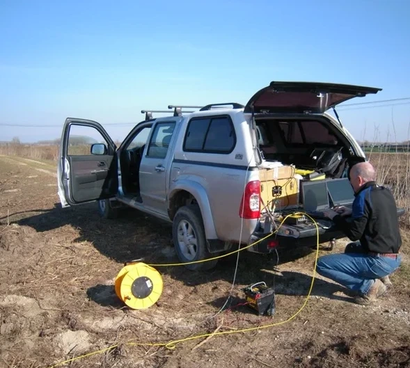
The survey kit for an Exeter urban line starts with a 24-channel Geometrics Geode seismograph, cabled to 4.5 Hz or 14 Hz geophones on spike bases. For reflection work we deploy a 100 kg accelerated weight drop mounted on a tracked carrier—critical on the narrow medieval lanes around the Cathedral Green where vibrator trucks cannot access. The biggest technical risk is ambient noise: Exeter’s bus corridors and the railway line to St Davids generate 30–80 Hz ground roll that masks first arrivals. We stack 5 to 8 blows per shotpoint and apply bandpass filtering in the field. Another hazard is coupling loss on made ground. The former gasworks site near Haven Banks sits on 4 metres of cinder fill; geophone spikes simply bounce. There we use plaster-of-Paris pads and halve the array spacing to recover coherent refractions from the underlying sandstone.
Our services
Seismic data only becomes a ground model when it is processed and interpreted for the specific question the engineer is asking. Our Exeter surveys target four distinct applications:
Bedrock rippability & excavation assessment
P-wave velocity contour maps at 0.5 m intervals, classified against Caterpillar D8–D11 rippability charts. Critical for basement excavations in Heavitree Breccia where blasting is prohibited.
Karst and dissolution feature detection
High-resolution reflection profiling over the Pinhoe gypsum beds and the Broadclyst breccia to map voids, collapse structures, and subsidence zones before piling.
Vs30 and seismic site classification
Combined SH-wave refraction and MASW to deliver a measured Vs30 value per Eurocode 8 (BS EN 1998-1) for Seismic Class D or C determination.
Cut-and-cover alignment surveys
Long refraction lines along proposed utility corridors, delivering continuous bedrock profiles for trench stability design and temporary works specification.
Common questions
How much does a seismic tomography survey cost in Exeter?
A typical single-line refraction survey (24–48 channels, 100 m spread) runs between £2,450 and £4,370, depending on line length, channel count, and access constraints. Reflection surveys with a mechanical source start higher due to the heavier equipment and longer acquisition time. We provide a fixed-price proposal after reviewing the site location and target depth.
What depth can refraction tomography reach in Exeter's Permian geology?
With a 115 m geophone spread and a 7 kg sledgehammer, we typically image 25–35 m below ground surface in competent Heavitree Breccia. In weathered sandstone, penetration drops to 15–20 m. For deeper targets, we switch to reflection acquisition, which can map horizons at 80–150 m depth using an accelerated weight drop.
How long does a survey take and what is the site footprint?
A 100 m refraction line takes one field day: setup, shooting, and breakdown. The footprint is a single line of geophones—no drilling or excavation. We need pedestrian or vehicle access along the line. In busy areas like the city centre, we work early mornings to reduce traffic noise.
Do you provide a Vs30 report accepted by Exeter City Council building control?
Yes. We deliver a signed report with the measured Vs30 value, the velocity profile, and the seismic site class per BS EN 1998-1. This has been accepted on multiple residential schemes in the Exeter area. We tie all coordinates to OS National Grid and include the raw SEG-Y files for third-party review. More info.